The Seeberg Round — One of My Favourite Hikes
The Seeberg. The mountain that rises on the other side of the valley, opposite the Tannerhof. The reason we get only four to five hours of sun in winter. The mountain whose name has puzzled me since childhood, because where, exactly, is the lake ("See")? The mountain whose reputation didn't improve from being made to climb it in primary school.
That's different now. When I come back to Bayrischzell after a longer absence, the Seeberg is, by preference, one of the first peaks I climb. To say "hello, I'm back," for the overview, the inventory — what's new, what's the same, are all the mountains where they belong?

The trail begins at the mini-golf course,
signed for Seeberg. From the Tannerhof's front door it's a quarter-hour walk; if you're meeting someone and running late, you can also go by bike or car. There's a hikers' car park (EUR 5/day, free with the guest card).
For the first stretch I climb directly above Bayrischzell. When the trees clear, I catch glimpses of the valley while making good ground on the path. After about half an hour, I leave the shaded north flank behind me, heading east, and Bayrischzell drops out of sight. Now, with the Kleines and Großes Traithen on my left, I follow the trail through patches of relatively young forest — decades ago, a violent storm felled whole stands here. Past the spot where, as primary school children, our class teacher pointed out the herb Paris and impressed its toxicity on us; past the sparingly trickling St. Joseph Delicius spring, I finally reach the gate to the alpine pasture and know the Neuhütte is not far now.
I could look forever from up here
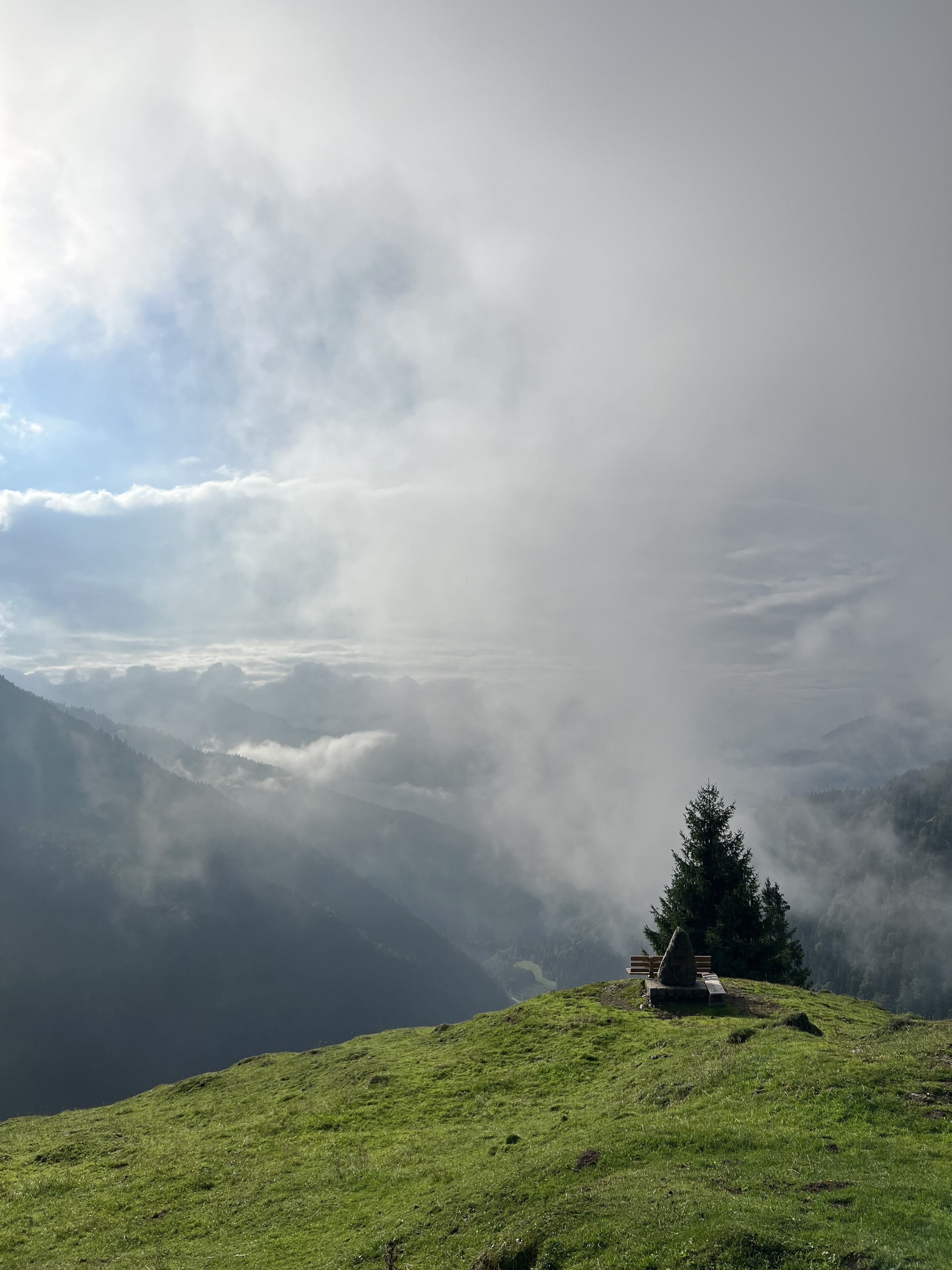
Reaching the hut, I rest a moment by the standing stone "Auf der Wacht" and the bench in front of it. A plaque on the stone commemorates the Bavarian mountain riflemen during the conflict between Tyrol and Bavaria in 1805–1809. It's easy to imagine they had a watchpost here. Spread before me lies the Ursprung valley: the bright winding of the road, the lush green meadows, and the soothingly dark forest climbing the hillsides; the foothills of the mountains interlocking until they vanish at the horizon. I could look forever from up here. And yet I have to move on. The Seeberg is calling.
From the Neuhütte I follow the blue-marked path, which rises gently along the south side of the mountain. In the distance I briefly catch sight of the high plateau with the Niederhofer and Klarer Almen, which my hike will later cross. Wreathed in clouds, sometimes clearly visible, sometimes only as silhouettes, the Ruchenköpfe, Rotwand and Hochmiesing put on their show as I make brisk progress to the Seebergalmen.
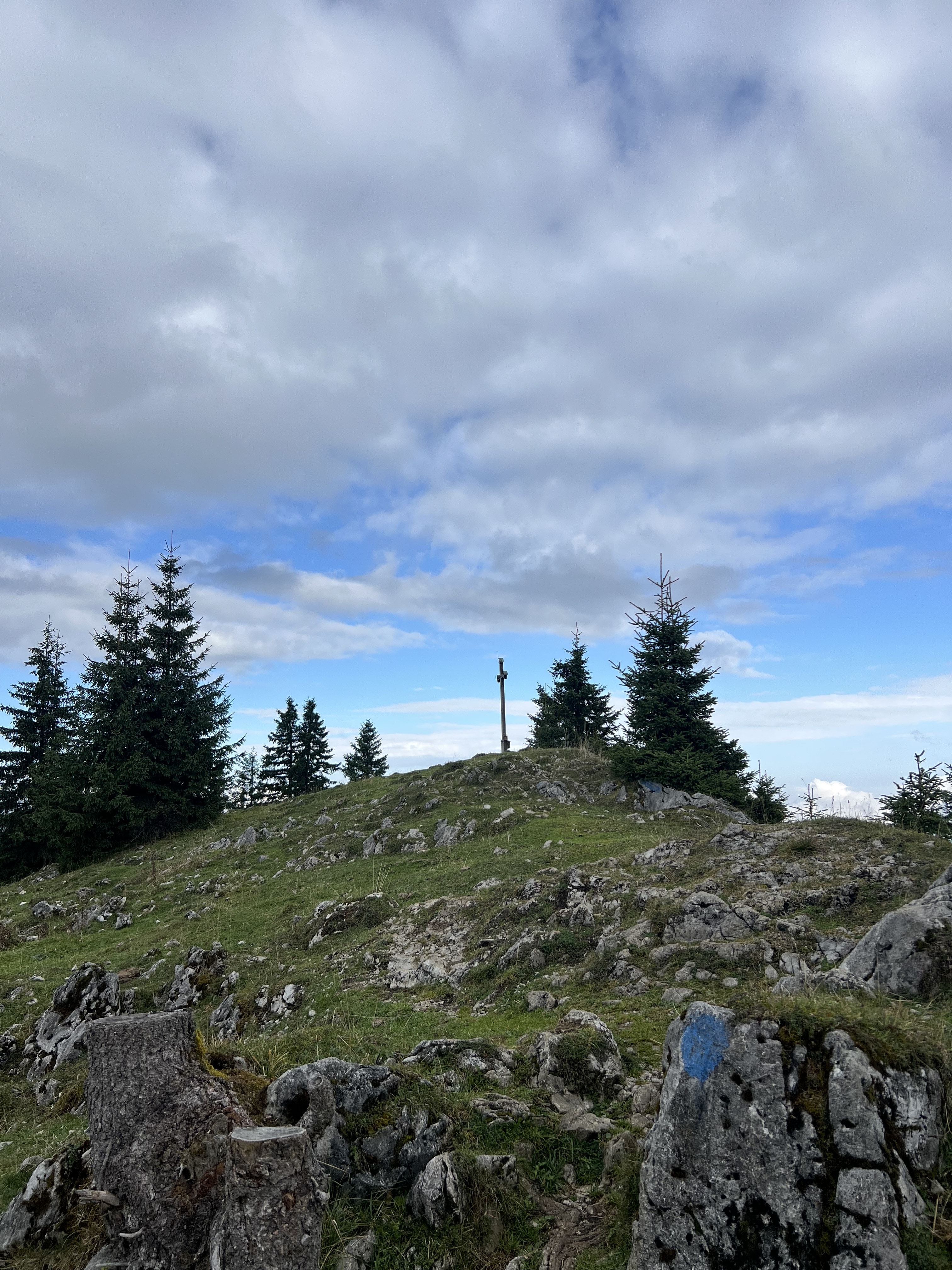
There, after the small stone wall, I bear right. The trail gradually steepens, becomes wooded, root-tangled. Through the trees, I can see the sky like a promise about to be kept. After two hours of walking and 800 metres of ascent, it lies before me: the bare crown of the Seebergkopf. A few more steps to the summit cross, and there I drink in the view.
Here in the valley the view is clear; on a few slopes, ragged clouds still cling.
Directly opposite rises the Wendelstein. To the east, you get a sense of the mountains behind the mountains. And of the mountains behind the mountains behind the mountains. A bird's-eye perspective on Bayrischzell. There's the Tannerhof. The roof of the Alte Tann shines, and the towers, and as a new arrival, the Badeharpfe nestles into the slope. My eye follows the streets, the familiar paths through the village, looking laughably short from up here. It traces the Alpenstraße out to Osterhofen and Geitau, then disappears towards Schliersee and Fischbachau. Cars small and busy as ants. Over the lowlands the clouds gather. I nod with satisfaction — everything's in its place.
Onward.
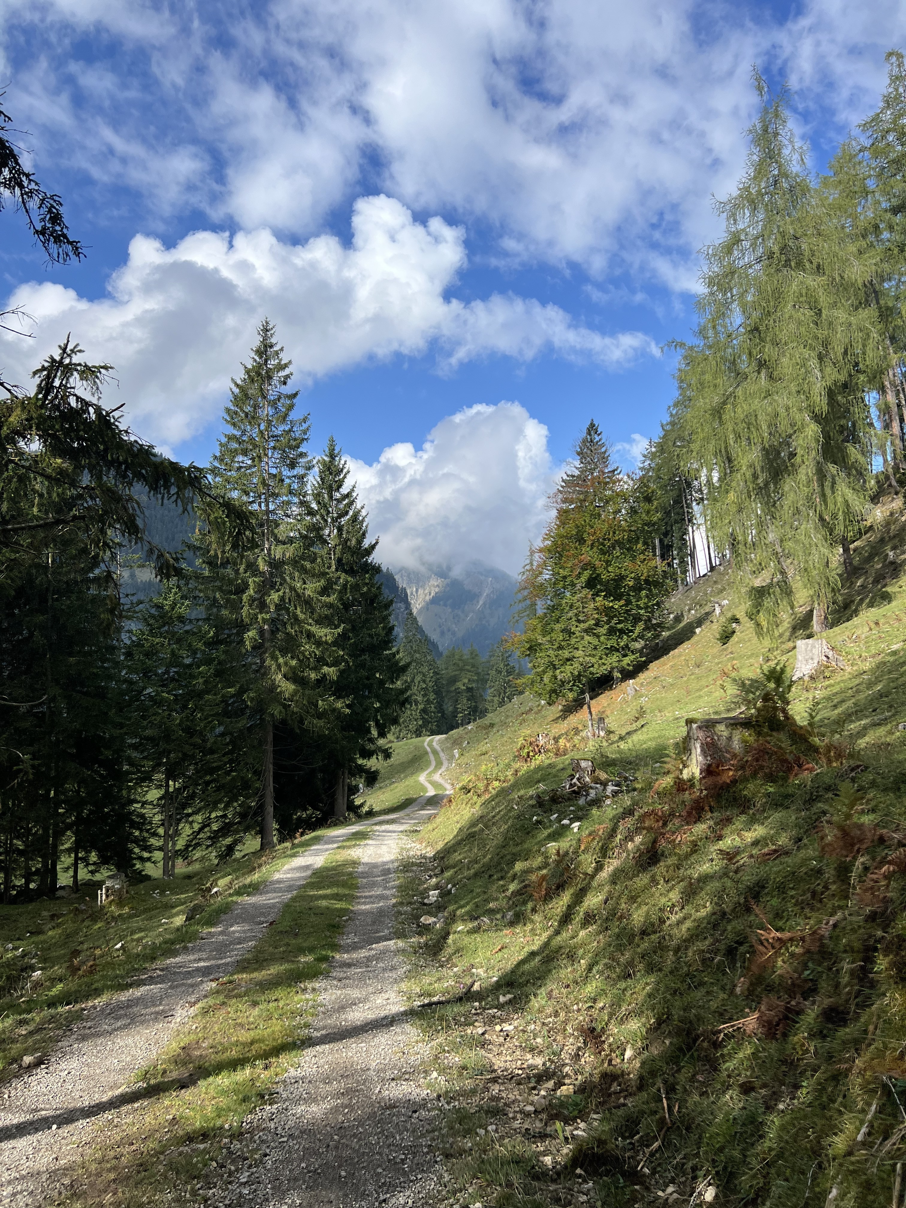
The descent first follows the same path back to the Seebergalmen. There, coming from the mountain, I keep right and pass the front of the alms. Because the trail isn't immediately obvious here, blue dots have been generously scattered like breadcrumbs. The way leads downward. Down through scattered spruce and larch, until the path ends on a forestry road. From there it continues downhill, while a view of the high plateau — the one I had seen earlier on the climb to the Seebergalmen — opens up on the left.
The road describes a wide curve, and past the Klarer Alm I come to a junction. Right would lead down to Geitau; I turn left and through the gate. I look down the Wackbach valley. In the distance, two old friends greet me: the Kleines and Großes Traithen. I linger a few hundred metres on the forestry road, but before reaching the Niederhoferalm, I cross right across a meadow, where a narrower path takes me onward. Soon I leave the plateau behind, winding through the damp forest until I cross the Wackbach via a small metal bridge.
The path narrows to a trail. The valley narrows too: to the left, it climbs steeply up to where, somewhere, the Neuhütte stands watch over the Ursprung valley. To the right, it falls steeply, where the brook and time have washed basins into the mountain. Its rushing will accompany me all the way down. I enjoy the wilder mood of the valley, looking up, looking down, while with every step the mountains grow taller. And just as the Wackbach eventually meets the Sillbach to become the Aubach, which becomes the Leitzach, my path eventually runs out and joins the wider hiking path, which I follow towards Bayrischzell. The last stretch is a "Hatscher" — a slog — as the unwritten law of hiking dictates: however strenuous the climb may have been, it's always the final stretch that drags. It's like the hangover the next day; it's always the last beer.
But even the slog comes to an end, and I reach the Kneipp basin and so the Melkstatt. Now I can decide whether to take the path directly to the Tannerhof, or whether to walk on alongside the Aubach — which only really runs after heavy rain or the snowmelt — along the foot of the Seeberg, back to the car park. The view makes the legs lighter.
I'm glad. That was a beautiful day.
Tour key data
- Length — approx. 15–16 km
- Elevation gain — approx. 740 m
- Starting altitude — approx. 800 m above sea level
- Seebergkopf — 1,538 m above sea level
- Time — approx. 4.5–5.5 hours
Good fitness, sturdy footwear, sure-footedness and a head for heights are required.
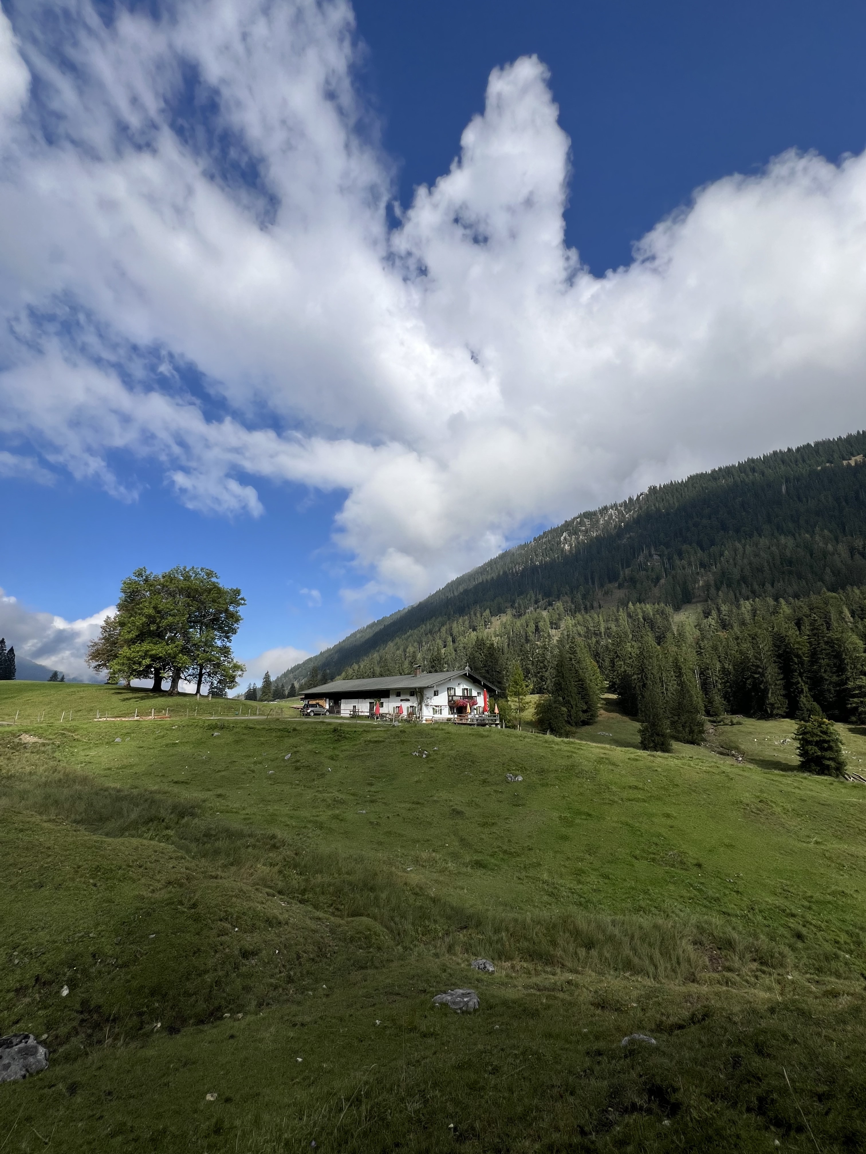
The alms mentioned are operated only intermittently; please check in advance with the Bayrischzell municipality, or bring your own provisions.
The route can be walked in either direction.
Markings
- Trailhead — Neuhütte: path B2, signed Seeberg, marked red–white–red
- Neuhütte – Seebergkopf: signed Seeberg, marked blue
- Seebergkopf – Niederhofer-Alm: signed Niederhofer-Alm, marked blue
- Niederhoferalm – Bayrischzell: signed Bayrischzell (via Ursprung valley)